

You hire a surveyor, and a few days later, you get a clean map with straight lines and exact numbers. It looks simple. Still, that result depends on something most people never notice. Surveying companies don’t begin by measuring your property right away. They start by locking into fixed reference points called control points. That first step sets the tone for the entire survey.
If the starting point is right, everything lines up. If it’s off, even by a small amount, the error spreads across the property.
That’s why this part matters more than most homeowners think.
What control points really are
Control points are fixed spots with known coordinates. They act like anchors on the ground. Every measurement connects back to them.
These points can be metal rods, concrete markers, or GPS-based locations already mapped in the area. Surveyors use them to tie your property into a larger system of known positions.
Without control points, measurements would float without a reliable base. That’s when lines don’t match, corners shift, and confusion starts.
Why surveying companies rely on them first
Accuracy doesn’t come from the tool alone. It starts with where the work begins.
Before anything gets measured, professional surveying companies take time to set control points. That step keeps everything steady and lines the work up with official records and past surveys.
A small mistake at the start might not seem like a big deal. Over distance, though, it adds up. That’s how a fence ends up in the wrong spot or a building sits too close to a line.
Control points help avoid those problems early, before they turn into something harder to fix.
How this works in Oklahoma City
Oklahoma City already has established control points across many areas. These are known locations that surveyors can use as a starting base.
Because of that, surveying companies in Oklahoma City often begin by checking those existing points. They confirm the coordinates, then tie your property into that system.
This local setup helps surveys stay accurate across different projects. It also makes it easier to compare new surveys with older records.
What happens once the crew arrives
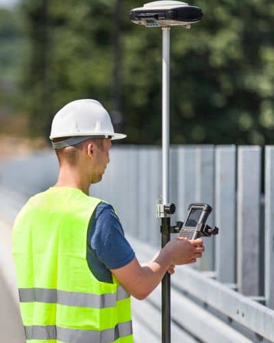
When the survey team shows up, they don’t jump straight into measuring your lot.
They first locate nearby control points or known markers. After that, they verify those points using GPS equipment. If needed, they set temporary control points on your property to keep everything aligned during the job.
From there, every line, corner, and elevation ties back to those reference points.
So while it may look like simple measuring, each step connects to a verified starting position.
Why this matters for your property
This step affects more than just lines on paper. It affects real decisions.
Accurate control points help make sure fences sit in the right place. They guide where a home or driveway should go. They also support smooth property sales since buyers rely on clear boundaries.
When the starting reference is solid, everything else becomes easier. When it’s not, small issues turn into bigger ones.
That’s when delays, rework, or disputes begin.
What can go wrong without proper control
Not every problem comes from poor work. Sometimes the issue starts with weak reference data.
If control points are outdated or not verified, the results can shift. That shift might not show right away. It often appears later, when something doesn’t match what’s on the ground.
At that point, a second survey may be needed to sort things out.
That’s time and money most property owners didn’t expect to spend.
When you should ask about control points
Most clients never bring this up, but it’s worth asking.
If you’re building something new, buying land, or dealing with past survey differences, it helps to know how the work starts.
Surveying companies should be able to explain how they verify their reference points. You don’t need technical details. A clear answer usually shows they take accuracy seriously.
How modern tools support this process
Today’s surveying companies use GPS and digital tools to check control points faster and with better precision.
Even so, the process still depends on proper field checks. Equipment helps confirm positions, but surveyors still compare results with records and make sure everything lines up.
Technology speeds things up. It doesn’t replace careful work.
Choosing surveying companies in Oklahoma City
Not every company follows the same level of detail.
Some move quickly and skip steps. Others take time to confirm every starting point before measuring anything else.
If you want reliable results, choose surveying companies that know Oklahoma City well and understand local control points.
That local experience makes a real difference in accuracy.
Why this step makes everything else work
Every survey depends on where it begins.
Control points give that starting place a solid foundation. When those points are correct, the rest of the survey holds together.
When they’re not, problems show up later, often when it’s harder to fix them.
That’s why surveying companies focus on control points, even if clients never see it.
It’s quiet work, but it’s the reason your survey stands up when it matters most.