Technology does not usually change all at once. Instead, small improvements add up over time. Right now, those improvements are pushing lidar mapping forward faster than many people expect.
New remote-sensing tools make LiDAR mapping quicker, smoother, and easier to use. For property owners, developers, engineers, and city planners across Oklahoma, this shift already affects how land projects begin and move forward.
So what has changed, and why does it matter to clients? Let’s take a closer look.
Why LiDAR Mapping in Oklahoma Is Moving Faster Than Before
LiDAR mapping has been used for years. However, recent upgrades removed many delays that used to slow projects down.
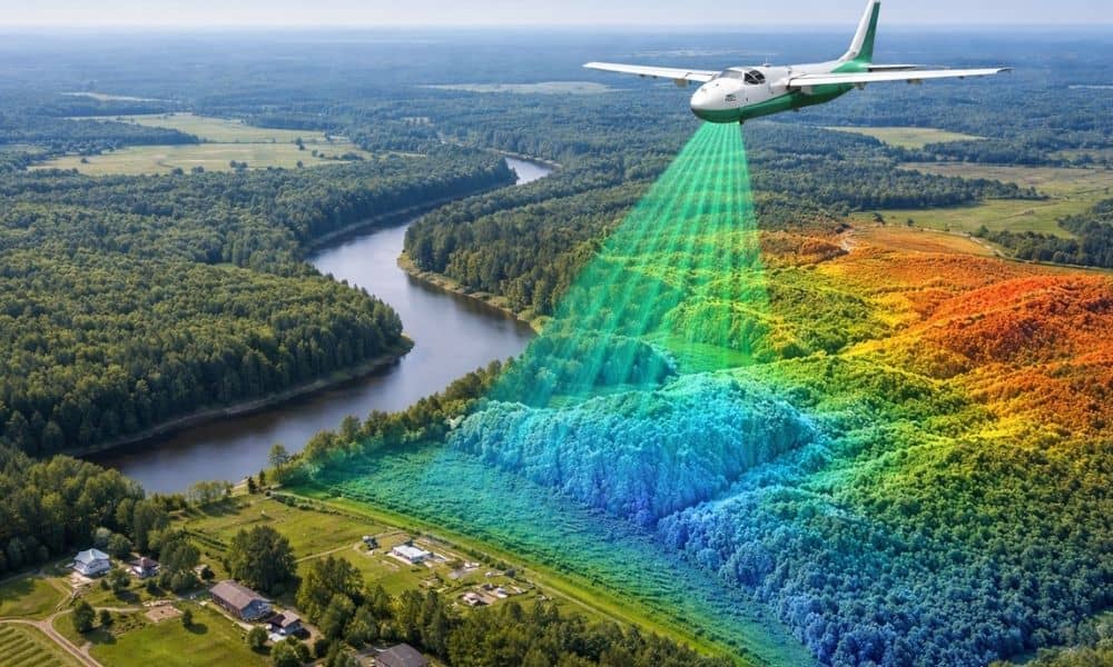
Today’s LiDAR systems can scan large areas faster and with more detail. Because of that, teams can move from data collection to planning much sooner.
In Oklahoma, timing matters. Development moves fast, weather changes quickly, and delays raise costs. Faster LiDAR mapping helps projects stay on schedule from the very beginning.
What Changed in Remote-Sensing Technology
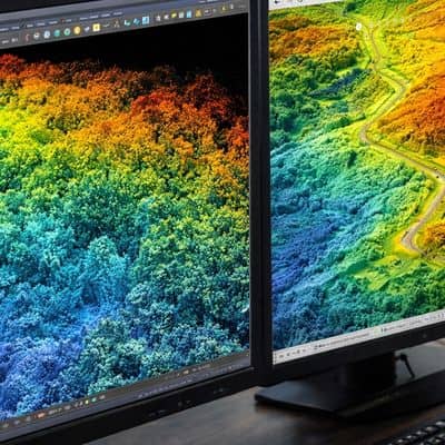
Several updates are working together behind the scenes.
First, airborne sensors now collect more data in less time. That means fewer flights or passes are needed to cover a site.
Next, software improved. New programs turn raw LiDAR data into usable terrain models faster than before. What once took weeks can now take only days.
Also, better positioning systems keep data lined up across large areas. This helps when projects cover many acres or happen in phases.
Together, these changes speed up lidar mapping oklahoma without lowering quality.
Faster LiDAR Helps Teams Make Decisions Earlier
One of the biggest benefits appears early in a project.
Before buying land or finalizing designs, teams need to understand the site. Modern LiDAR mapping gives that view sooner. Instead of guessing about slopes, low spots, or drainage paths, decision-makers can see them right away.
Because of this, developers can judge land earlier. Engineers can find problems sooner. Property owners can understand risks before spending money.
Earlier information leads to better choices and fewer surprises later.
Less Field Time Means Less Disruption
Another major change is how much time crews spend on-site.
Older survey methods often required long field visits. While those methods still matter, modern LiDAR mapping reduces how often crews must return to the same location.
With better remote sensing, much of the terrain data comes from above. This means fewer disruptions to homes, roads, and job sites.
In Oklahoma, this matters a lot. Weather shifts fast, rural land can be hard to reach, and busy areas have safety concerns. Less field time makes projects easier for everyone.
Large Sites Gain the Most Right Now
As LiDAR technology improves, large sites benefit even more.
Big land areas once took a long time to map well. Now, modern LiDAR captures steady data across wide spaces in one effort. This reduces gaps and errors.
In Oklahoma, this helps with subdivisions, road projects, utility planning, and large developments.
When all project phases use the same base data, teams work better together. Designs match the land more closely. Cost estimates become more reliable.
New LiDAR Data Stays Useful Longer
Older elevation data may seem fine at first. However, land changes faster than many people realize.
Grading, erosion, new buildings, and drainage changes can make old data unreliable. When teams rely on outdated information, small mistakes can turn into big problems.
Modern lidar mapping oklahoma shows the land as it looks today. That current view helps reduce redesigns and change orders later.
While no data lasts forever, newer LiDAR gives projects a stronger start.
Faster Mapping Improves Teamwork
Speed does more than save time. It improves teamwork.
When LiDAR data arrives earlier, engineers can start design work sooner. Planners can review options without waiting. Contractors can prepare for site conditions before work begins.
As a result, teams communicate better. Questions get answered early. Fewer guesses slip into the design.
For fast-moving projects, this can prevent delays and confusion.
What Clients Should Expect from LiDAR Mapping Today
Today’s technology raises expectations.
Clients ordering LiDAR mapping in Oklahoma should expect faster results. They should also expect clear files that work well with design and planning software.
Still, technology alone is not enough. Skilled professionals must review the data, check elevations, and make sure results fit the project.
The best results come from combining modern tools with local experience.
Why This Matters for Oklahoma’s Growth
Oklahoma continues to grow and change. New neighborhoods, roads, and utilities all depend on good data.
As remote-sensing tools improve, LiDAR mapping becomes a basic part of planning, not an extra step. It supports smarter land use, better drainage planning, and smoother construction.
Most importantly, it lowers risk. When teams understand the land early, projects move forward with confidence.
Final Thoughts
The recent rise in remote-sensing technology is more than a tech upgrade. It is a real change that affects real projects across the state.
Faster lidar mapping means quicker decisions, fewer delays, and better teamwork. For property owners, developers, engineers, and planners, this leads to clearer answers and stronger results.
As Oklahoma continues to build, LiDAR mapping will guide better choices. And with today’s tools, it does that job faster and better than ever before.