
Drone mapping feels fast. A crew shows up, launches a drone, and gathers images in less than an hour. From the outside, it looks simple. However, recent drone airspace crackdowns across the country show a different side. In some cases, officials shut down airspace with little warning. Flights stopped overnight. Projects paused right away. That kind of problem does not just affect hobby pilots. It affects building projects, site plans, and land development. If your Oklahoma City project depends on aerial mapping, speed alone will not protect your schedule. A licensed land surveyor will.
Drone Mapping Is Fast — Until It Is Not
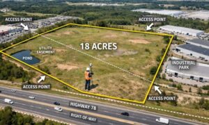
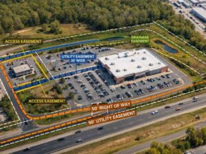
Developers and homeowners often expect drone surveys to move quickly. Many times, they do. Drone mapping covers large sites in less time. It helps engineers design grading plans. It supports drainage work. It gives builders clear elevation data.
Yet drone flights must follow strict FAA rules. Airspace near airports, military bases, and controlled zones requires approval. Oklahoma City has all of these.
For example, projects near Will Rogers World Airport or Tinker Air Force Base sit in controlled airspace. That means survey teams must get flight approval before launch. In addition, temporary flight restrictions can appear due to events or safety concerns.
So while drone mapping looks easy, it still has limits.
When a team ignores those limits, delays happen.
What Happens When Drone Flights Stop
At first, a delayed drone flight seems small. You just move it to another day, right?
Unfortunately, the problem spreads fast.
Engineers cannot finish plans without topographic data. Permit applications slow down. Contractors wait to start. Equipment bookings shift. Owners grow frustrated.
In commercial projects, every lost day can cost real money. On home projects, delays create stress.
Often, that chain reaction begins with one mistake: someone assumed the drone could fly without checking the airspace.
A licensed land surveyor does not make that mistake.
Why a Licensed Land Surveyor Matters
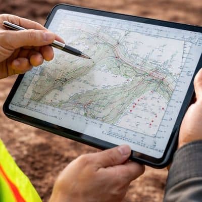
Many companies offer drone services. However, not all of them provide full surveying oversight.
A drone pilot focuses on flying. A licensed land surveyor focuses on the whole project.
Before going to the site, a licensed land surveyor studies the location. They review airspace rules. They check nearby airports. They confirm approval needs. They look for temporary flight limits.
Because of that work, problems show up early instead of on field day.
Even more important, a licensed land surveyor understands how the data connects to permits, design plans, and property lines. They do not treat drone mapping like simple photography. They treat it like a legal and professional service.
That difference protects your timeline.
Planning Keeps Your Project Moving
Strong projects do not rely on one tool alone.
If weather blocks a flight or a new restriction appears, a licensed land surveyor adjusts. They can use ground equipment, GPS tools, and total stations. They can mix methods to keep gathering data.
As a result, engineers still receive what they need. Your timeline keeps moving. Your contractor stays on schedule.
In contrast, a drone-only provider may cancel and wait. They may not have other options ready.
That gap can cost days or even weeks.
Rules Are Getting Stricter
Recent drone events have brought more attention to airspace safety. Officials now watch drone activity more closely. Rules continue to tighten.
That affects surveying work.
While drone tools improve each year, rules also grow stronger. Approvals matter. Records matter. Licensed oversight matters.
In Oklahoma City, where airspace stays active, compliance cannot be an afterthought.
A licensed land surveyor stays up to date with these rules. They work within them from the start.
Because of that, your project avoids risk.
The Risk of Choosing the Wrong Provider
Budget always matters. However, the lowest price does not always mean the best choice.
If a provider skips airspace checks or lacks proper licensing, problems appear later. Engineers may reject the data. Permit offices may ask for changes. Contractors may question the elevations.
Then you pay again.
Worse, if officials ground the drone during the project, delays grow even longer.
A licensed land surveyor carries legal responsibility. Oklahoma law holds them accountable for accuracy and standards. That responsibility protects you during permits and inspections.
So you are not just paying for images. You are paying for protection.
Oklahoma City Projects Need Experience
Oklahoma City continues to grow. New stores, neighborhoods, warehouses, and roads move forward every year.
At the same time, airspace rules remain active and complex.
Because of that, aerial mapping must follow clear rules.
A licensed land surveyor understands local conditions. They know how survey data supports civil engineering plans. They see how delays affect contractors and owners.
Most importantly, they prepare for problems before they happen.
Protect Your Timeline From the Start
Every project carries some risk. Weather changes. Costs shift. Permit reviews take time.
Drone mapping should not add more stress.
When you hire a licensed land surveyor, you hire someone who looks at the full picture. They think about your design schedule, your construction start date, and your long-term investment.
They plan before they launch. They confirm approval before they fly. They adjust when conditions change.
As a result, your project stays steady even when airspace rules shift.
Drone mapping remains a powerful tool. However, tools alone do not protect your timeline. Experience and licensing do.
So before your next Oklahoma City project begins, make sure the professional behind the drone is a licensed land surveyor.
Because when rules tighten and flights stop, the right expert keeps your project moving forward.