Do you own land along a rural road? Does that road follow or run close to a section line? If so, you may wonder where your land really starts and stops. The road itself won’t tell you. A boundary survey will. It can help you avoid guessing about something that matters when you build, fence, or sell your property.
Many rural roads follow old section lines. These lines come from the original Public Land Survey System. That history shapes how a surveyor looks at your land today. It also explains why the road you see and the line you own are often not the same thing.
Why Section-Line Roads Create Unique Boundary Questions
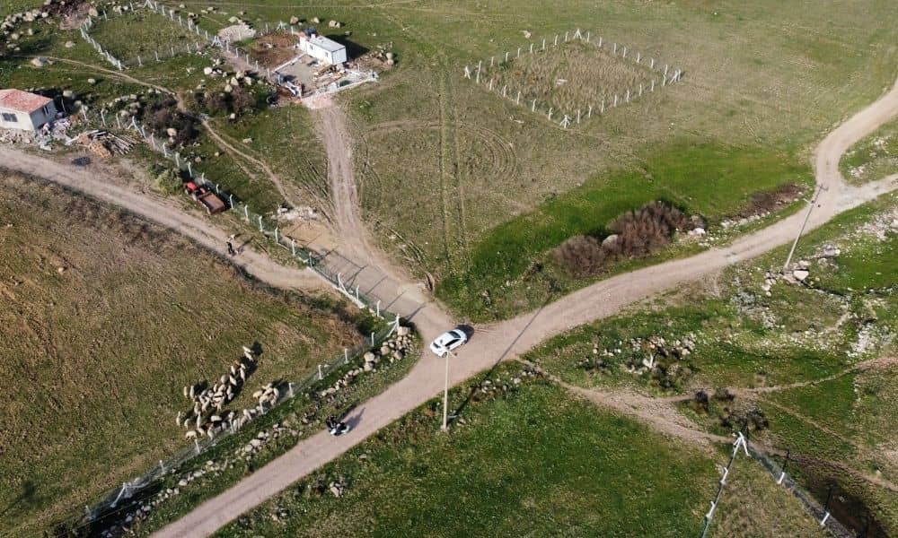
A section-line road follows a line drawn long ago, when land was split into one-mile squares. Over the years, the road itself can move away from that old line. Construction, road repairs, and drainage work can all shift it. So the road you drive on today may sit a few feet, or more, from your real property line.
This raises a real question for property owners. If your deed says your land borders a section line, you need to know what that means in real life. Does it match the road? The right-of-way? Neither one? A surveyor answers this by checking old survey records and finding the corners that set the line. The surveyor does not just measure from the edge of the pavement.
This matters most when you plan to build, fence, or add something near the road. If you guess at the line based on where the road looks like it sits, you could end up building in the wrong spot.
Where the Road Sits Compared With the Surveyed Parcel
A boundary survey shows your property lines. It also shows the section-line right-of-way next to or crossing your land, when one applies. Oklahoma’s survey rules call for this right-of-way to be shown or noted on the drawing. The rules also call for any visible road evidence on the property to be shown. This gives you a clear picture of how your legal boundary lines up with the road.
In many cases, the road sits inside the right-of-way instead of right on the section line. The width of that right-of-way can change depending on how the road was built and whether it was ever widened or moved. A survey shows that width. It also shows where your land begins on the other side of it.
This matters for anything you plan to build near the road. If you place a structure, fence, or driveway based on where the road edge looks like it sits, instead of the surveyed line, you could end up inside the right-of-way. You could also end up closer to your neighbor’s line than you meant to be.
How Section Corners Help Establish the Property Location
Section corners are the points that anchor the whole Public Land Survey System grid. They matter a lot for finding a rural property along a section-line road. A surveyor uses these corners, whether they are original or rebuilt, to figure out where your property lines fall within the section.
Finding these corners takes fieldwork. It also takes research into county records, old survey maps, and any papers that show a corner was rebuilt. Corners can get buried, moved, or lost after years of farming, building, and road work. So a surveyor often has to rebuild a corner’s true spot using nearby clues and standard survey methods. The original marker may be long gone.
Once the surveyor confirms the section corners, they can measure out to your land with confidence. This is the core work behind a rural boundary survey. It is also why section-line properties often take more research than a simple lot in a subdivision with a clear plat.
When Roadside Improvements Make a Survey Worth Considering
If you plan to build anything near a section-line road, get a boundary survey first. This includes new fencing along the road, a new driveway, a shed or small building near the front of your land, or grading work close to the right-of-way.
Building without a current survey means you are guessing about where your land begins. That guess can be wrong. This is common on rural land, where the last survey may be old. It may not show road widening, ditch work, or utility changes that have happened since.
A survey also gives you something to point to later, if a question comes up. This could be from a neighbor, a title company, or a county office reviewing your permit. A clear drawing of your boundary and the right-of-way puts you in a much stronger spot than pointing to where you think the line runs.
Using Survey Results Before Rural Site Planning Begins
If you build, develop, or invest in rural land near a section-line road, a boundary survey is a smart first step. It confirms how much usable land you have once the right-of-way is set aside. That affects your setbacks, your access points, and how much space you have left to build on.
This matters even more for larger rural tracts near growing areas outside Oklahoma City. Farmland near these areas is increasingly being eyed for homes or businesses. A clear picture of the boundary and right-of-way early on can help you avoid costly design changes later. This happens when a planned driveway or building turns out to sit inside the right-of-way or over the true property line.
Share your survey results with your design team before you lock in a site plan. This gives everyone the same starting point, instead of guessing where the road and the property line actually meet.
Frequently Asked Questions
Does a section-line road automatically show where my property ends?
No. The road you see does not always mark your legal boundary. The road may sit inside a right-of-way that is wider than the pavement itself. This means your real property line could sit back from what you see on the ground. A boundary survey finds the true line using section corners and recorded documents, not the visible edge of the road.
Can a boundary survey show a section-line road right-of-way?
Yes. Oklahoma’s survey rules call for a section-line right-of-way to be shown or noted on the drawing when it touches or crosses your property. This gives you a clear record of the right-of-way width next to your boundary lines.
Why can the road and the surveyed section line look different?
Roads get repaired, widened, or moved over time for drainage or safety reasons. The section line itself does not move, but the road built near it can drift away from that original spot. A survey separates what you see on the ground from what the legal records show.