Oklahoma City keeps growing. New roads and wider highways promise easier travel and more business. However, growth can also bring problems. The recent turnpike expansion debate has many property owners feeling unsure. People now ask a simple question: What happens if this project touches my land? That question leads to one key answer — land surveying.
Most people picture heavy machines when they think about road work. In reality, every project starts with measuring land. Before anyone moves dirt, someone must confirm where property lines sit. When land becomes part of a public project, those lines can shape legal rights, payment amounts, and even neighbor relationships.
Growth and Property Rights
The Oklahoma Turnpike Authority plans to improve traffic flow and prepare for future growth. On one hand, better roads help the city move forward. On the other side, nearby property owners worry about losing part of their land.
When the government uses eminent domain, it can buy private land for public use. Even so, the process depends on clear boundaries. A small shift in a property line can change how much land gets taken. It can also change how much money the owner receives.
That is why land surveying plays such an important role.
Without clear measurements, no one can say exactly how much land a project needs. As a result, disputes often begin when lines on paper do not match what owners believe is true.
Why a Few Feet Can Make a Big Difference
At first, a few feet may not sound like much. However, in property matters, even inches can matter.
For example, imagine a fence that has stood for 20 years. The owner believes the fence marks the true property line. Then a survey shows the legal line sits three feet inside that fence. Suddenly, the right-of-way for a new road affects more land than expected.
The same issue can happen with driveways, sheds, barns, or even trees. Some may sit partly inside easements without the owner knowing. When a large project begins, those hidden issues come to light.
Because of this, land surveying often reveals problems before talks even begin.
What Land Surveying Really Does
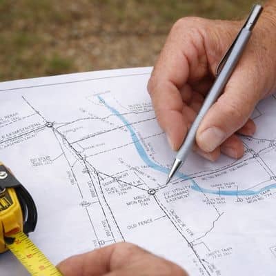
Many people think land surveying only helps builders place homes or mark lot corners. In truth, it protects property rights.
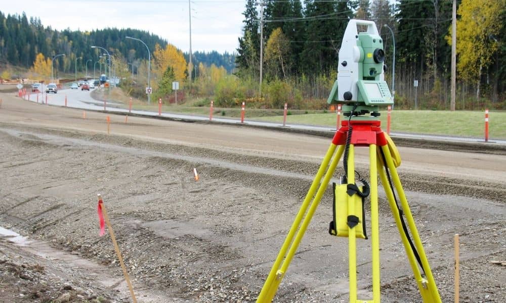
First, a survey confirms the legal boundary using deed records and old plats. It compares those records with what stands on the ground today. If differences appear, the surveyor works to resolve them based on rules and evidence.
Next, a survey finds easements. These may include utility paths, drainage areas, or access routes. During a turnpike project, easements can affect what land officials can use.
In addition, a survey records existing features. That includes fences, pavement, and buildings. These features can affect how much compensation an owner receives.
In short, land surveying provides clear proof.
Oklahoma City’s Changing Landscape
Oklahoma City covers a large area. It includes neighborhoods, farmland, and business districts. Because of this mix, every property looks different.
Some rural land still uses older legal descriptions tied to natural landmarks. Meanwhile, newer neighborhoods rely on recorded subdivision plats. Each type needs careful review.
Also, development near the edges of the city often moves fast. Land that once felt far from traffic may now sit close to a planned corridor. Therefore, property owners who never worried about boundaries may now need answers.
When Neighbors Start Asking Questions
Large projects can also cause tension between neighbors.
For example, two neighbors may believe they know where their shared line sits. Once survey crews place markers, they might learn the fence stands a few feet off the legal line. That discovery can lead to stress.
Although the turnpike project may not fully take their land, it can still require clear boundaries. In those moments, land surveying offers neutral facts.
Clear data removes guesswork. Instead of arguing based on memory, neighbors can rely on measurements.
Why Online Maps Are Not Enough
Many property owners check online maps for quick answers. While those tools help with general location, they do not replace a professional survey.
Online parcel maps often include warnings. They may show rough lines but lack legal accuracy. Therefore, relying on them during a dispute can cause problems.
If payment or property rights are involved, accurate land surveying provides stronger protection.
Steps Property Owners Can Take
Even if your property does not sit directly in the turnpike path, it helps to prepare.
First, review your latest survey if you have one. Make sure it matches your deed and shows current improvements. If it is very old, it may be worth having it reviewed by someone familiar with properties. Local land surveying experts often spot small boundary details that property owners overlook, especially when nearby development could change access or right-of-way lines.
Next, confirm that fences and structures sit within legal lines. Fixing small issues now prevents bigger ones later.
Finally, keep records organized. Clear documents make discussions smoother if questions arise.
Proactive land surveying gives peace of mind before problems grow.
More Than One Project
The turnpike debate may dominate the news today. Still, Oklahoma City will keep growing tomorrow. Roads will expand. Utilities will shift. New developments will appear.
Each change connects to property lines in some way. Because of that, land surveying will remain important long after this one project ends.
The Bottom Line
Growth and property rights can exist together. However, clarity must come first. When officials plan projects, they depend on accurate boundaries. When homeowners protect their land, they depend on the same thing.
Land surveying stands at the center of that balance.
If you own property near growing areas, now is the time to understand your boundaries. Clear measurements protect your investment and prevent disputes.
Oklahoma City will continue to grow. Through every change, one truth remains: careful land surveying protects both progress and property rights.