Land often has more than one surface lease on it at the same time. A pipeline might cross one corner of the property. A compressor site might sit on another part. A tank battery might sit on a third spot. Each lease was likely written at a different time. Each one may use different reference points. When a buyer, lender, or attorney tries to match these papers to the real land, gaps and overlaps often show up.
A due diligence survey helps fix this problem before a deal closes. It ties every lease to one shared set of survey points. It shows where each leased area sits on the ground today. It also shows how much land is left outside of any lease. For anyone working on an energy property deal, this information can affect the price, the loan terms, and what the buyer can do with the land after closing.
Build a Parcel-and-Lease Exhibit Register
The first step is building a list that shows every parcel and every lease tied to it. This list becomes the main guide for the rest of the survey work.
Lease maps are not all made the same way. Some are hand drawn. Some use an old land description. Some come from a digital file made for one pipeline or well pad. Before a surveyor can compare anything, all these papers need to be pulled together. Each one gets matched to the right parcel and the right lease.
This step also catches simple mistakes early. A lease might point to an old parcel that has since been split into smaller pieces. Two lease maps might describe the same easement with different directions or numbers. Finding these problems now saves time later, when crews are out in the field trying to find the real lease lines.
Tie Every Surface Lease to Common Survey Control
Once the lease papers are sorted, the surveyor sets up one shared set of survey points that covers the whole property. Every lease line, whether it came from a pipeline deal made years ago or a lease signed last month, gets measured from that same shared point system.
This step matters because lease papers are often made without any link to each other. They may use different starting points or different measuring systems. Without shared points, it’s hard to know if a gap between two lease lines on paper is a real gap on the ground or just a mix up in how each paper was measured.
Tying everything to one shared system puts all the leases on equal ground. A buyer or title company can then see how the leases truly relate to each other in real space. They no longer have to trust paper descriptions that may not agree with one another.
Reconcile Lease Geometry With Energy-Site Occupation
A lease paper shows where a pipeline or well site is supposed to sit. A due diligence survey checks that against where the pipes, roads, and buildings really sit today.
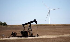
Central Oklahoma has a long history of oil and gas work. Land near Oklahoma City is often still active, or it was active not long ago. Equipment does not always stay inside the lines on the old lease map. A tank might have been rebuilt a bit off from its first spot. A road might have shifted to avoid a wet part of the field. Small shifts like these can add up over time. The paper and the real ground can end up telling two different stories.
This step gives a buyer a clear view of where the real equipment sits, not just where the lease says it should sit. That difference can change how much open land is truly free to use. It can also show if any equipment sits outside its lease line, which may need to be fixed before or after closing.
Measure the Uncommitted Land Between Lease Areas
Once every lease is placed and checked against the real ground, the survey can show how much land is left outside of any lease. This number is often different from what you’d get by simply subtracting lease sizes from the total land size.
Open land is not always one neat block. It can be broken into small pieces by roads or pipeline strips. Some of these pieces may be too narrow or oddly shaped to use for much. A due diligence survey shows exactly where this open land sits and how it connects to other open areas and to public roads.
This is one of the most useful parts of the whole process. A buyer who wants to use the land later, whether for farming, homes, or business, needs to know more than just the total open acres. They need to know the shape, the location, and how to get to it.
Define Transaction Deliverables Before Surveying Begins
Before the survey crew starts work, it helps to decide what the survey needs to produce for the deal. A simple land purchase may only need a boundary map and lease drawing with acreage numbers. A deal that involves a lender may also need a report that covers specific lease issues tied to the title.
Deciding on these needs early, along with the attorney, title company, or lender, keeps the survey work matched to what the deal really requires. It also avoids delays that happen when someone finds out mid project that more paperwork is needed after the crew has already left the site.
Setting these needs early is even more useful when several surface leases are involved. Each lease may have its own terms, end dates, or renewal rules that could affect how the deal gets documented.