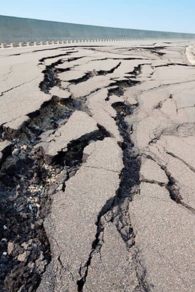
In late September, many people across Oklahoma City felt the ground rumble. A 3.7 magnitude earthquake struck near Prague, shaking homes and sparking plenty of “Did you feel it?” posts on social media. While the tremor didn’t cause major damage, it left homeowners wondering: could an earthquake shift your property lines? The short answer is no—your legal boundaries are set by deeds and county records. But the physical signs of those boundaries, like corner markers, pins, and even fences, can move or get disturbed. That’s where a property survey comes in. It gives you a clear picture of your land after a seismic event and peace of mind that nothing has changed where it matters most.
Earthquakes and Oklahoma Soils
Oklahoma isn’t California, but tremors here are more common than many people realize. Central Oklahoma sits on soft soils that can amplify shaking. Even a modest quake can cause subtle changes: corners shift slightly, old fence posts lean, or cracks form near foundations.
If your home sits on clay-heavy soil—a common condition in Oklahoma City—the ground expands and contracts with moisture. When a quake hits, that movement adds to the stress. The result might not be dramatic damage, but it can be enough to knock an old survey pin out of alignment.
Property Lines Don’t Move, But Markers Can
It’s important to understand the difference between legal lines and physical markers. Your property lines are written in the official record and don’t change with an earthquake. However, surveyors rely on physical evidence like iron rods, monuments, or other markers to show those lines on the ground.
When the soil shifts, those markers can tilt, sink, or move. A fence that once looked straight may suddenly look off. To a homeowner, that creates confusion. To a neighbor, it can spark a disagreement. A property survey reestablishes the original lines and clears up any questions.
What Homeowners Should Watch For

After a quake, you don’t need to panic, but it helps to walk your property with a careful eye. Look for things that weren’t there before. Are there small cracks in your driveway or near your patio? Do your corner markers sit higher or lower than before? Has a fence line started to lean even though it looked fine last week?
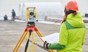
These are signs of minor ground disturbance. Alone, they don’t mean your property shrank or expanded, but they do suggest it may be time for a professional check. A property surveyor can compare your lot with the legal record and confirm that your corners are still accurate.
Why a Property Survey Matters After a Quake
Think of a property survey as a reset button. It’s not about redrawing lines but about confirming the ones that already exist. After a quake, that confirmation can save you stress, money, and potential disputes.
For example, if your neighbor plans to rebuild a fence that now looks “off,” a recent property survey gives you both a fair starting point. If you’re thinking about adding a shed or driveway, the survey ensures you build on your land—not over the line. And if you decide to sell your home in the future, having updated survey records builds buyer confidence.
Another benefit is peace of mind. Many homeowners worry about unseen problems after the ground shakes. A property survey takes away that doubt and replaces it with clear, measurable facts.
When Elevation Becomes Part of the Picture
Property surveys aren’t only about lines—they can also connect to elevations. In Oklahoma City, neighborhoods near Deer Creek, the Blue River, and other low-lying areas sometimes need elevation certificates for insurance or construction.
An earthquake, even a small one, can shift drainage patterns or create new low spots. That’s why surveyors often recommend checking elevation along with property lines after ground movement. Knowing both protects you from surprise flood risks and keeps you compliant with FEMA or city requirements.
Oklahoma City’s Growth Adds Pressure
As Oklahoma City keeps growing, land conditions get more complicated. New construction, heavy equipment, and constant development all put stress on the ground. When you add an earthquake into the mix, it’s one more factor that can nudge an old marker or tilt a fence.
Older neighborhoods are especially at risk because their property markers may be decades old. In many cases, those markers are shallow or hidden. A quake can loosen them even further. Without a survey, homeowners may not notice the change until a project or dispute forces the issue.
How to Decide If You Need a Survey
Not every quake means you must call a surveyor. However, you should consider one if:
- You see fresh cracks, leaning fences, or disturbed markers.
- You’re planning to build or sell soon and need accurate records.
- Your property sits near flood zones and you want both line and elevation data.
A property survey is a modest investment compared to the potential cost of disputes, construction delays, or insurance issues. And in a city like Oklahoma City, where both natural tremors and human development shape the land, it’s a smart step toward security.
Final Thoughts
The recent Oklahoma quake is a reminder that the ground beneath us is always moving, even if only a little. While your property lines don’t legally shift, the physical markers that show those lines can. That’s why a property survey matters after seismic events. It confirms your boundaries, protects your rights, and gives you peace of mind.
If you noticed anything unusual on your property after the quake—or if you simply want certainty—reach out to a licensed surveyor. A survey today could save you from bigger headaches tomorrow.


