If you live in Oklahoma City, you might have heard about the recent increase in ALTA land title survey contracts. But what exactly is an ALTA survey? Why are so many of these surveys needed now? And how does this affect the roads, bridges, and buildings we use every day?
What Is an ALTA Land Title Survey?
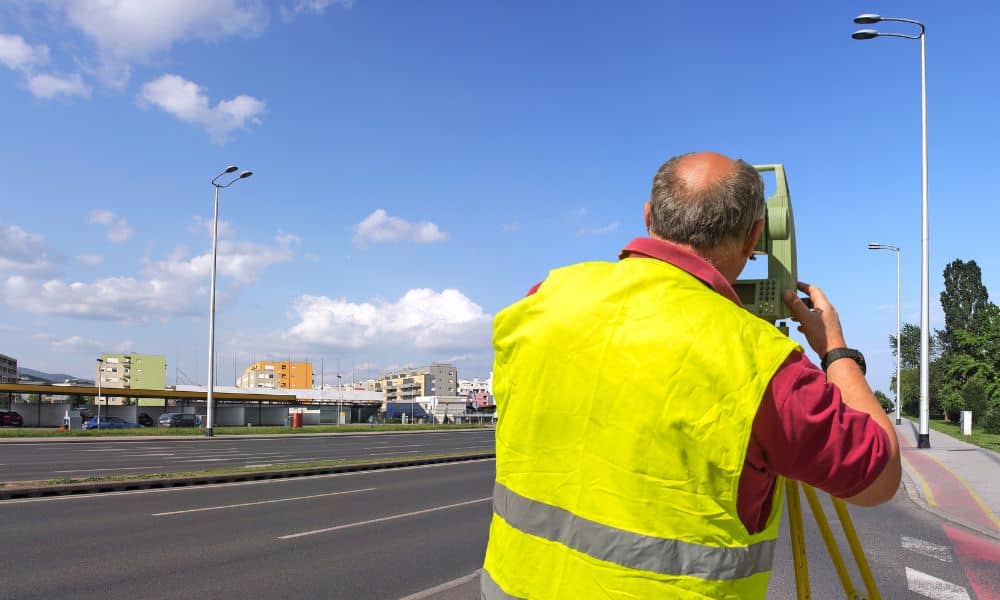
An ALTA land title survey is a detailed kind of land survey used mostly for commercial properties. It shows not only the property boundaries but also things like buildings, fences, utility lines, and easements. Easements are rights other people or companies may have to use part of the property, like for power lines or shared driveways.
These surveys follow special rules made by the American Land Title Association (ALTA) and the National Society of Professional Surveyors. Because of this, they give very clear and trusted information about the land.
Why Are ALTA Surveys in High Demand?
In May 2025, the Oklahoma Department of Transportation (ODOT) approved a $15 million contract for land surveying services across the state. This contract covers many kinds of surveys, but ALTA surveys are especially important.
ODOT will use these surveys for many infrastructure projects, such as building new roads, fixing bridges, and other public works. Because of this, surveyors are busier than ever before. The demand for ALTA land title surveys has increased a lot.
How Do ALTA Surveys Help Infrastructure Projects?
Think about what happens before building a new road or fixing a bridge. The builders need to know exactly where property lines are and what is on the land. ALTA surveys give them that information.
These surveys also show if there are any hidden problems, like underground utilities or flood zones. If the builders don’t have this info, they might accidentally build on private land or hit a utility line. That can stop work and cost a lot of money to fix.
Because ALTA surveys are very detailed, they help make sure that construction projects can go ahead without big delays or legal trouble.
What Does This Mean for Oklahoma City?
For the people who live and work in Oklahoma City, this increase in ALTA surveys means better roads, safer bridges, and stronger public buildings. When surveyors do their job well, construction crews can work more quickly and avoid surprises.
Also, since ODOT hired several surveying companies for this big contract, there is more competition among surveyors. That can lead to better prices and faster service for anyone who needs an ALTA survey, like business owners or developers.
So, whether you are buying commercial property or planning a new building, this surge in surveys makes it easier to get the detailed information you need.
How Technology Is Changing Land Surveying

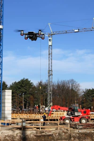
One of the reasons surveyors can handle more work now is because of new technology. Drone land surveying and aerial surveying have become very popular.
Survey drones, also called unmanned aerial vehicles (UAVs), fly over land to take pictures and collect data. This helps surveyors make very accurate maps in less time than walking the land.
In Oklahoma City, these drones are now often used in ALTA land title surveys. They can spot things that might be missed on the ground, like small changes in the land’s elevation or hidden structures.
Using drones helps surveyors finish their work faster and more accurately, which is good news for construction projects and property owners.
What Should Property Owners and Developers Do?
If you own commercial property or are planning to buy or build, you should understand why ALTA land title surveys are important.
Before you buy land or start a project, get a licensed land surveyor who knows ALTA rules to do a survey. This helps avoid problems later, like legal disputes or project delays.
With the recent surge in contracts, now is a good time to schedule your survey early. Don’t wait until the last minute, or you might slow down your project.
Also, learn about new survey tools like drones. These can improve the quality and speed of your survey.
What’s Next for ALTA Surveys in Oklahoma City?
This surge in ALTA land title surveys is probably just the beginning. Oklahoma City is growing, and there will be more infrastructure work and new buildings in the future.
As surveying companies get better technology and experience, surveys will become even faster and more accurate.
ODOT’s big $15 million contract shows that the state wants to make sure infrastructure projects are planned carefully and built safely.
For residents and businesses, this means better roads and buildings for years to come. For surveyors, it means more work and new chances to use advanced technology.
Why This Matters to You
You might wonder why all this surveying talk should matter to you. The truth is, ALTA land title surveys help protect your investment in property.
If you are buying commercial land, an ALTA survey makes sure you know exactly what you’re getting. It also helps banks and lenders feel confident about giving loans because the land’s boundaries and conditions are clear.
If you’re involved in a construction project, accurate surveys mean fewer surprises and faster completion.
In short, ALTA surveys help save time, money, and headaches.
Final Thoughts
ALTA land title surveys may sound complicated, but they are essential for keeping infrastructure projects on track.
The recent $15 million ODOT contract means many more ALTA surveys will be done soon. This will help build better roads, bridges, and buildings for everyone.
If you’re a property owner, developer, or just curious about how these projects come together, understanding ALTA surveys gives you a better idea of what’s happening behind the scenes.
So next time you drive on a smooth new road or cross a strong new bridge, remember the careful work of surveyors who made it possible.
If you’re curious to learn more about ALTA land title surveys or want help finding a licensed surveyor, local experts are ready to assist. Having the right survey can really help your project run smoothly.


