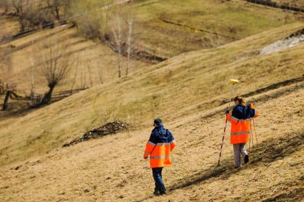
Oklahoma City’s mix of flat lots, sloped land, and clay-based soils makes site planning tricky. A topographic survey (topo survey) gives a clear picture of your property’s elevations, drainage patterns, and features so your project is designed to work with the land, not against it.
What Is a Topo Survey and Why It Matters
Unlike a standard boundary survey that focuses only on property lines, a topo survey also shows the shape, elevation, and features of the land, including:
- Elevation changes and slope direction
- Trees, driveways, fences, and other features
- Drainage paths and low points on the property
- Utilities, manholes, and other site elements
In Oklahoma City, these details matter. The area has a mix of flat lots, sloped terrain, and clay-based soils that can hold water. Without a topo survey, you risk drainage problems, uneven grading, or costly design changes later.
When a Topo Survey Is Needed
You might need a topo survey if you are:
- Building a new home or commercial property
- Adding onto an existing structure
- Installing a driveway, retaining wall, or pool
- Preparing land for subdivision or development
- Submitting plans for city permit approval
In many cases, the City of Oklahoma City requires a topo survey as part of the site plan review process. Working with experienced land surveying services in Oklahoma City can help ensure your plans meet local requirements and avoid costly delays.
How to Prepare for a Topo Survey

1. Gather Property Records
If you have deeds, past surveys, or site plans, share them with your surveyor. This can make the work faster and more accurate.
2. Mark Key Areas and Features
Flag fences, utility boxes, or any structures that need to be shown on the survey.
3. Ensure Easy Access
Clear away vehicles, debris, or locked gates so crews can reach all areas of the property with their equipment.
4. Explain Your Project Goals
Let the surveyor know if you plan to build, grade the land, or address drainage issues. They can collect extra details during the visit that may help your designer or engineer later.
What Happens During the Survey
In Oklahoma City, most topo surveys take one to three days for on-site measurements, followed by additional time to process the data and prepare the final map. The steps often include:
- Using GPS, total stations, or drones to measure points across the property
- Recording elevations and mapping features
- Creating a detailed topo map showing contour lines, slopes, and site elements
The final survey is usually delivered as a digital map that your project team can use for design and planning.
How to Read Your Topo Survey
Topo maps use contour lines to show elevation.
- Lines close together mean the slope is steep.
- Lines farther apart mean a gentler slope.
Other symbols mark buildings, trees, fences, and utilities. Even if you’re not a technical expert, understanding these basics helps you follow your project’s design process.
Mistakes to Avoid Before a Topo Survey
- Waiting too long to schedule — This can delay permits and construction start dates.
- Not clearing the site — Obstacles can slow down the survey and reduce accuracy.
- Forgetting about neighbors — If crews may need to access areas near property lines, give your neighbors a heads-up.
Final Thoughts
A topo survey is more than a box to check for permits — it’s a roadmap for building successfully on your land. With accurate elevation and site data, you can design smarter, avoid costly rework, and keep your project on track.
Preparing for your topo survey in advance can mean fewer delays, clearer communication with your project team, and a smoother path from plans to a completed build — which is why it’s best to have a topographic survey done before your project starts.


